Best Drone Services Denver - Drone Photography Service for commercial projects
Drone service for your project in denver
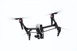
Sky Drone Solutions provides professional drone services for business that need data and insight for their projects.
Get a fixed cost quote for insurance with aerial drone photography services, collecting visual data, and progress monitoring and other applications for businesses where you need the data but don’t have the tools.
Let’s look at how we can use drones in construction progress, aerial photography, and real estate assets.
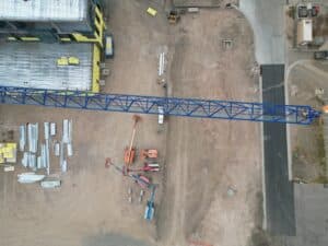
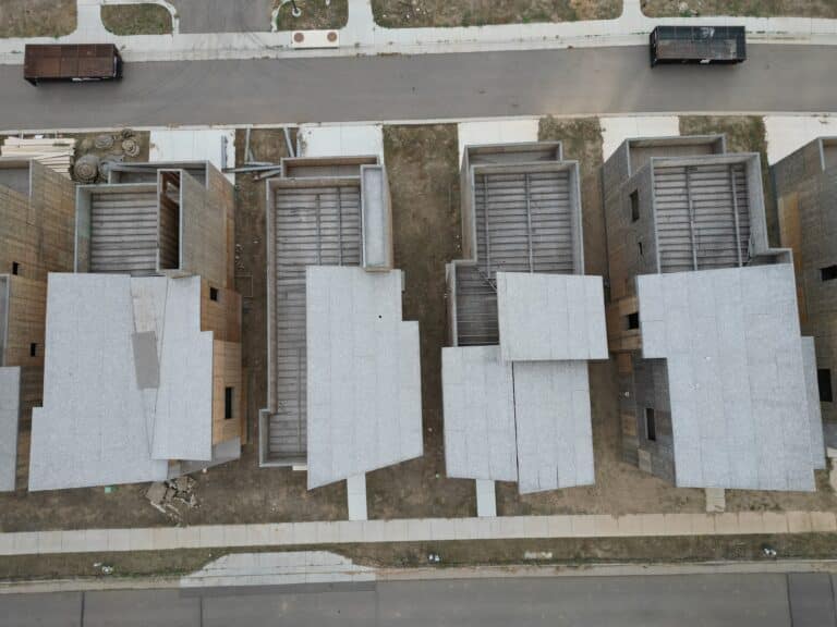
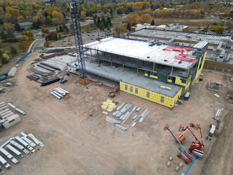
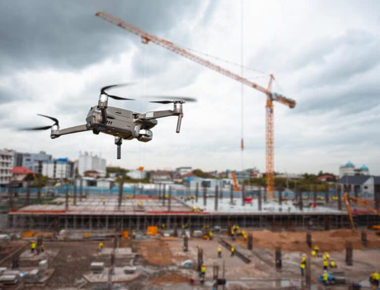
Most of the time, a drone is used in the construction progress to survey and inspect.
With sensors that point straight down, drones can quickly and accurately collect data from the sky and provide aerial imagery.
These sensors could be RGB or multispectral cameras, thermal detectors, or devices that use light to measure distance (lidar).
Companies can also use drones for roof inspection aerial imaging.
- Quality building and safety inspections
- Use less resources on projects
- Manage projects with real data
- Bring the job site to you
Uses of aerial services, including inspections
Drone imaging services are used for many purposes in Colorado. Drones can also help cities with a number of services.
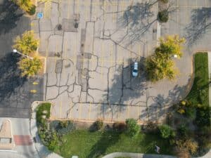
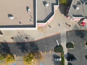
Sky Drone Solutions will capture footage from unique perspectives. Photogrammetry programs then use this photography to generate two- and three-dimensional maps with precise geographic coordinates.
Drone Aerial services, which include photogrammetry software and video, further the technology by combining photography to make georeferenced 2D maps, elevations, and 3D models.
With the help of these drone-generated maps, valuable information like distance, surface area, surrounding area, and volume can be extracted with the help of these maps.
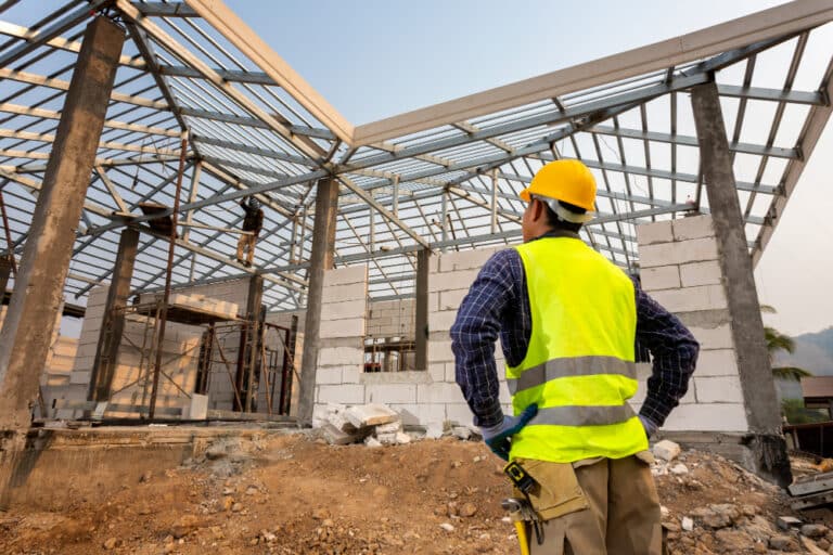
Instead of sending someone on a ladder and risking an accident, use what you should know about a drone and take a safe approach know how to use a using our drone services with video for a roof inspection.
Consider using drone technology to check hard-to-reach locations or assess and optimize drone-capture data for construction progress site projects.
-
commercial projects with drone solutions
-
measure materials at construction sites
-
fixed rate quotes for drone services and aerial photography
Colorado’s premier drones company
It has never been easier to use drone technology to take pictures from above of some of the earth’s most beautiful (and sometimes inaccessible) places with specialized services.
Imagine the travel time you will save by using a drone company with an unmanned aircraft with a camera on board, taking professional images and less worker accidents means a potential reduction in insurance.
Save money and time on Roof Inspection
Drone solutions can also enable stakeholders to survey to minimize post-construction progress financial penalties from lack of maintenance and environmental damage with tailored services.
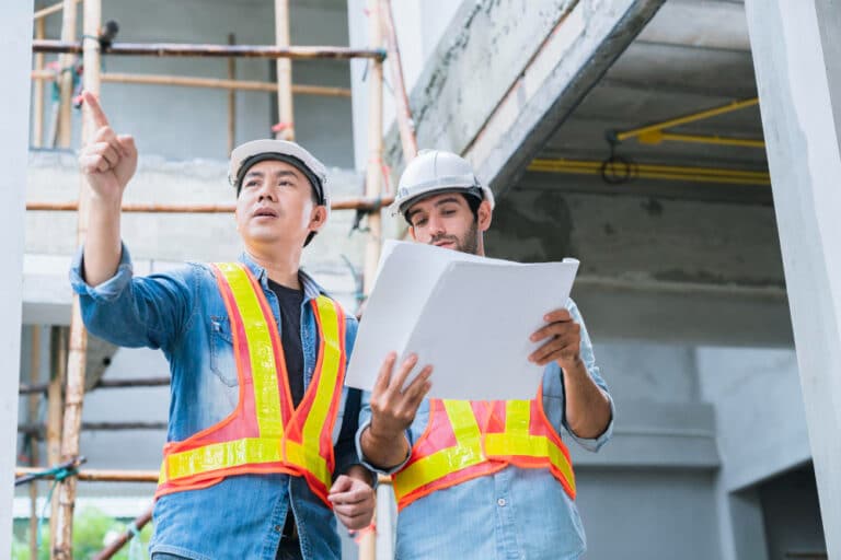
Drone photography using a qualified drone pilot can help tackle extensive and costly surveys, early discovery of construction progress mistakes, penalties for missing deadlines, miscommunication between stakeholders and contractors, progress at a construction site, and volumetric evaluation services.
building monitoring
Facade Inspections
Progress reports
Construction Projects
Superb drone services in colorado
Track Inventory
Optimize Project Costs with denver drone expertise
Using our drone solutions and drone pilots to take beautiful aerial photography and video from above is relatively new in the world of real estate, but very beneficial for clients.
Drones are used for marketing almost every kind of real estate, from homes and apartments to resorts and even empty land and business properties.
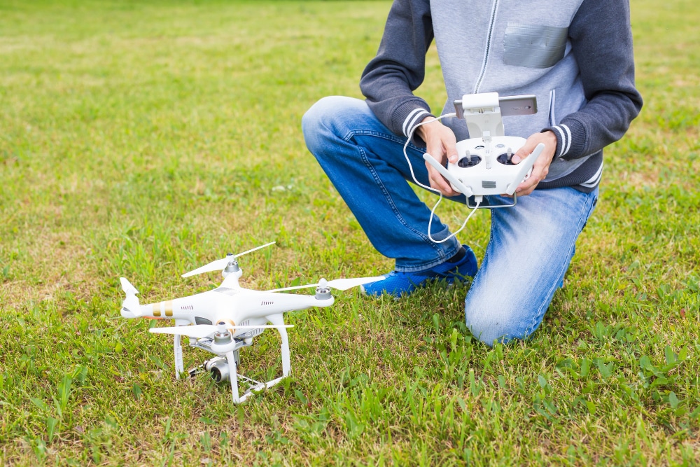
Modern drone cameras can take still aerial photography, videos, multiple bird’s-eye views of a location, and even 360-degree panoramas for a complete analysis of a particular location or tethering a drone is also an option but just make sure your Mavic is charged and ready to use.
Aerial Visuals drone services for commercial properties
In the real estate business, drones are most often used for residential and commercial listings.
When it comes to homes, most of the customers are real estate agents who want a choice of eight to ten interesting aerial photography.
Examples range from small parking lots or large malls to massive mansions on hundreds of acres.
use a Drone to get the real data with video and make your clients happy
In the commercial real estate business, drones benefit investment companies, development companies, and agents who want to sell shares in big projects like buying land, renovating buildings, or building new ones. They also provide invaluable inspections for project analysis, giving stakeholders a complete view.
Aerial photography using drone services is a better way to take pictures and videos of the whole site using the same techniques but from a higher vantage point.
construction projects
job site inventory reporting
building roof Inspections
Progress Reporting
Track earthworks and materials
improve site safety and compliance
Mapping services
With a real estate drone and drone photography, you can get a bird’s-eye view of a property, which can be a great way to showcase the surrounding area.
When it comes to more significant properties, you can only see part of the location, which can mean significant visual information is missed. Drone technology offers a solution by capturing expansive views that are otherwise challenging to obtain.
“Stitching” several pictures into one giant image can be done, however a continuous digital image taken by a drone gives the same result but with a lot more detail and sharpness.
You will get professional video and images for your business project at any location, our drone pilots are well trained and we’re an affordable drone company.
When drone mapping software is used, a drone can fly in straight lines between waypoints and automatically take photos.
Real estate drone video can help with getting a good view and understanding of the landscape of resort-style housing developments and vacation rentals, where a lot of property needs to be seen at one time for perspective.
Get A Free Quote Today
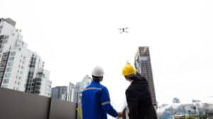
Are you interested in drone service? You can schedule a 30-minute phone session, and let’s discuss your project.
Let’s review your specific needs and drone requirements to provide you with the best possible service from Sky Drone Solutions Fort Collins and Denver.
We understand that no two projects are the same, and we will work with you to find a solution that fits your budget and timeline.
Sky Drone Solutions delivers real value as a drone services company so contact us to find out more!